Can Things Be Looking Up?
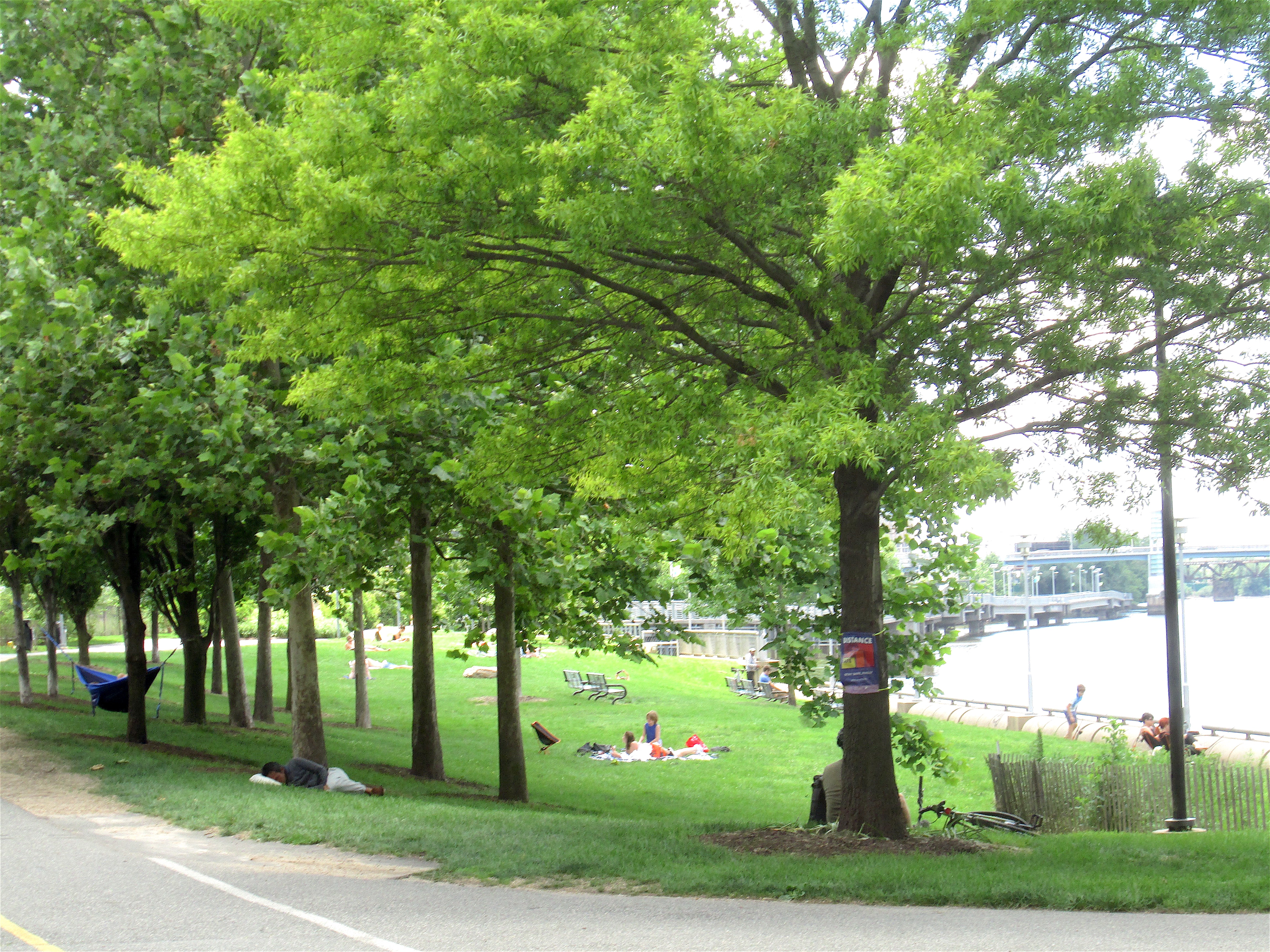
 |
| Coming off the ramp from the Schuylkill Banks. |
In my kinder and gentler moments, I have been known to refer to the 2300 block of Market Street as a godforsaken hellscape overrun by rampaging cars. But I think I may be about to change my mind. Things may actually be getting better here.
For starters, there's a new addition coming to the block, on the south side of the street, across from the black Peco tower on the north side. The current plan is to redevelop this space as a biotech center, preserving several of the existing facades. The larger new structure will provide a nice frame for the old facades while also making a modern statement of its own. All in all, I'm quite pleased with the evolution of planning for this area, and I'm thrilled that these dead buildings will be incorporated, at least in part, in a new life that will make this block much better. At least that's the plan. (For an article in Philadelphia YIMBY, click here.)
Dining al Fresco on 24th Street
Let's take a walk westward on the south side of Market, starting at 23rd street, where the new development is planned. You may notice, as you walk west from 23rd Street toward the Market Street bridge, that you are walking up a hill. The hill is actually the ramp up to the bridge. As you get to what would be 24th Street, there is a gap in the building facades, and you can look down to the real 24th Street. I did a little walking, and actually got a shot of this space looking north, back towards Market and the Peco building.
 |
| Sunday lunch on 24th Street. |
Talk about an adaptive reuse of a dead-end street. Talk about embracing our industrial past.
And talk about designing in three dimensions, and erasing the hard line between indoors and outdoors.
24th Street here is about two stories down from the surface of Market Street. The building on the west side of 24th - 2400 Market, better known as the Aramark building - has a north-south walkway that looks down onto 24th Street and runs all the way from Market to Chestnut. There is a little branch of this walkway that goes to a parking garage on the east side of 24th. I took the picture above while standing on that little branch (or bridge, if you want to be fussy).
Coming up with this stuff requires imagination.
Further west, the Aramark building has another, very nice, walkway that overlooks the river and also lets you promenade between Market and Chestnut. There are benches, and it's quite pleasant.
The view to the west may not enthrall everybody, but I find it interesting. You're basically looking at the guts of the city's transportation system as it has evolved over the centuries. The river, the railroad, the expressway. I like to call it Schuylkill, Schuylkill, and Banks. Has a nice ring to it.
Here's a picture of the railroad from the Market Street bridge, showing the Aramark building and its promenade on the left and the Schuylkill Banks on the right, with the ramp system that connects the bridges on Market and Chestnut with the Banks at ground level.
Learning from the Schuylkill Banks
I'm going to leave Market Street for a bit, and look more closely at the Schuylkill Banks in this area. I think there are some lessons here that could be applied on Market Street, and, frankly, in a lot of other places.
First, some history. In the days before railroads, the Schuylkill River was a very busy place. Now it is mainly empty, with a few pleasure boats, and the boat below, which is picking up trash. It's possible that, as it has grown less active, the river has grown more picturesque.
As we go further south on the Banks, we come to yet another bridge - this one is a bridge that picks up pedestrians and bicyclists and hoists them across the railroad tracks, around Spruce Street.
The picture above came from this bridge. I think many people find long lines of railroad cars - boxcars, flatcars, oil tankers - tedious. I don't, but I do understand the urge to decorate.
A few feet away, this is what the Schuylkill Banks looks like.
And if you go a block inland, you have scenes like this one on Panama Street.
Lessons to Learn
So why have I brought us all the way down from Market Street to Panama? Basically to show you how very different uses of space can be braided together and allow each use to do its job while allowing the other uses to do their jobs. This idea, weaving theoretically incompatible uses together, actually works on the Schuylkill Banks. The Markward Playground has a lovely area for small children that is located right next to the train tracks. The trains and the kids get along just fine. There is a fence.
The uses don't ignore one another. I would argue that they gain by having somewhat incongruous neighbors. One of the reasons why people come to cities is to rub shoulders with people who are different. Why should pieces of ground not do the same?
If the Schuylkill Banks can live with the train tracks, then Market Street can live with a bicyclist and her child mounted behind her. The question is how. And I think that the success of the Schuylkill Banks can suggest some answers. First, separate the different types of traffic and activities; second, weave them together so that everybody can get where they need to go.
On the Banks, of course, some people just lie quietly on the grass or in a hammock and don't do anything or go anywhere.
I'm not expecting a lot of napping on hammocks on the Market Street bridge, but I do think the idea of separating different kinds of traffic and then braiding them together intelligently wherever necessary - at intersections, for instance - would be remarkably helpful.
This would not solve all the problems on the 2300 block of Market, but I think it would help a lot.
I need to hammer home a point: Each of the zones we're talking about needs to find its own path to civilization. They should not all look alike. They have different tasks and should be designed to perform those tasks. But all of them can be civilized, and if they are, they will fit together to make a coherent and very pleasant slice of the city.
Back to Market
Let's go back to Market Street. Remember the photo at the top of this story - the bicyclist and her child. In the background you may notice a sliver of the Peco building. This building is large and black and very much of its time - 1970, to be exact. Most people driving by in a car probably only notice the tall black hexahedron. There are actually a number of other, smaller hexahedrons flanking the base of the tower. These smaller black boxes join together behind the tower and form a continuous facade along John F. Kennedy Boulevard. This facade on JFK has no entrances and no signage, with the exception of a few small notices that trespassers are unwelcome.
Let's go back to the Market Street frontage. On each side of the main entrance there is a plaza with a nice collection of trees. The street slopes here - remember you're on a bridge ramp - but the Peco building rests serenely on a horizontal plane, and so the eastern plaza is reached by steps up, and the western plaza is reached by steps down. The main entrance and the sidewalk are actually at the same level.
On the eastern plaza - the one with the steps up - there is a special entrance for Peco customers seeking solutions to problems. Here's a picture.
I have a problem with this entrance. In what way is it welcoming? How does it seek to create a feeling inside me that the people on the other side of the door will be nice to me, and perhaps even help me?
To me, at least, this entrance is cold and intimidating.
I don't really believe that Darth Vader lives in the Peco building. I do think it's a black hole in space that drains energy from the whole block.
It would be nice if a restaurant opened on the ground floor, with seating on the west plaza looking out to 30th Street Station and the old Post Office building. I do not think this will ever happen.
The Peco Parking Lot
On the other hand, I do think there are some significant, and possibly feasible, improvement opportunities on the block directly to the east of the Peco building, where Peco has a simply enormous employee parking lot.
(This picture is from the height of the pandemic. The statement that the lot is full is obviously false, but I learned in my corporate career that such statements should not be seen as false, but rather as "aspirational.")
This lot does not conform to Philadelphia's current design standards for parking lots. It doesn't have to. It was in existence when the new standards came in, and under the law it is grandfathered. So, no wrought-iron fences, no trees, no plantings of any kind. Essentially a visual disaster.
If it wanted to, Peco could comply voluntarily with the current design requirements for parking lots.
It could also put greenery at the curb, on Market, 23rd, and 22nd. I understand the conditions underground might not allow for tree pits in some places, but then there are planters.
Taming the Cars
That brings us to the street itself, a large and largely shapeless place where cars, buses, and trucks move quickly and maneuver abruptly in vast numbers. During the reconstruction of the Chestnut Street bridge, there was a protected bike lane on the south side of Market Street, from Schuylkill Avenue to 23rd. This has now gone away.
Meanwhile, the City has been working on putting a two-lane cycle track on Market, between 20th and 23rd. The necessary legislation has been passed, and construction is expected to start sometime this year. (For a brief description of this project, click here.)
West of 23rd Street, Penndot is getting ready to renovate the Market Street bridge. I long ago gave up trying to predict what Penndot may or may not do, but I'm hearing good things. A decent set of bike lanes here, or a two-way cycle track, could provide relatively clear sailing across the bridge and also connect to the ramp from the Schuylkill Banks. West of the river, Market is not a great place for bikes, but there are decent bike lanes on Walnut and Chestnut that extend well into West Philly. The recently revised Chestnut Street bike lane is, frankly, a gem.
What Does It All Mean?
Years ago, when I was commuting by train to New York, the Schuylkill Banks did not exist. I would leave 30th Street Station in the evening and sometimes I would walk toward home across the Market Street bridge. The bridge was a bit scary, because of the traffic; and then the stretch of Market east of the bridge always reminded me of Dante's line: Abandon all hope, ye who enter here. The Richard Basciano sex-industry empire dominated the area, especially when the few office towers emptied out at the end of the day, and the sidewalks were left pretty much empty. The Peco parking lot did not look out of place back then. All in all, not a great gateway to Philadelphia.
Everything that's now going on along this stretch of Market, from 20th Street to the bridge, suggests to me that we are about to fulfill a piece of Ed Bacon's vision of Market Street as Philadelphia's main axis, which he saw extending all the way to the city's western border. (See Edmund N. Bacon, Design of Cities, 1976, pp. 298-306.)
The emerging high-rise corridor along here is supported by abundant public transportation. There are quibbles and imperfections, of course. For historical reasons, the subway here, the Market-Frankford Line, does not stop between 30th and 15th Streets. (For more on this, click here.) But there are trolleys and buses. Five trolley lines run under Market between 30th Street Station and City Hall at 15th Street, stopping at 19th and 22nd. Seven bus routes have stops near the intersection of Market and 23rd.
I think things are genuinely getting better in this space, and not just for real estate developers. The area may soon be much more walkable. The sidewalks may have more foot traffic. Crossing the street may no longer feel life-threatening.
We may be in the process of making this stretch of Market Street safer, more useful, and more pleasant for all users. Will it be perfect? Certainly not. But I think we're about to take a big step forward in civilizing this street.
On its better days, the sign above says Walk Bike On Ramp. It's located at the top of the ramp that connects the Market Street bridge with the Schuylkill Banks. I think the decorations are a good reminder that users may disagree with the designers on how to use a particular piece of the built environment. Changing the design of the built structure is generally a more successful strategy than plastering the structure with signs. And this big ramp has been physically modified to prevent some of the most dangerous behavior.
In general, the designers of the Schuylkill Banks have been good at these modifications. There is, for instance, another ramp nearby, a gentle one at ground level, right next to the river near the Chestnut Street bridge. It used to have a series of almost invisible steps. Unwary bicyclists found themselves going airborne with some frequency, and not always landing well. The steps went away.
See also Putting Some Park into Old Parking Lots, Do We Secretly Want Ugly Cities and Dangerous Streets?