Sunday, December 4, 2022

Bluestone to the Rescue!

Every Street Needs a Gimmick


Have a look at the street in the picture above. It's really narrow, and it's surrounded by some pretty high buildings. Philadelphia has a bunch of streets like this. It's an old city. 

I see a lot of potential in these narrow streets with high walls. There's a lot of intrinsic drama here.

Years ago, narrow streets were a thing. Then along came the mania for wide streets - really wide streets - and people stopped paying much attention to the little ones. 

The street above is in the 2300 block of Ludlow, just south of Market and not far from the Market Street bridge. I think a lot of people don't even know it's there. It's easy to miss as you drive by on 23rd street.

Outdoor Rooms

It's not that people don't know about Philly's narrow streets, but I think it's fair to say that the picture which comes immediately to mind is something like Elfreth's Alley - a small residential street flanked by relatively low buildings.

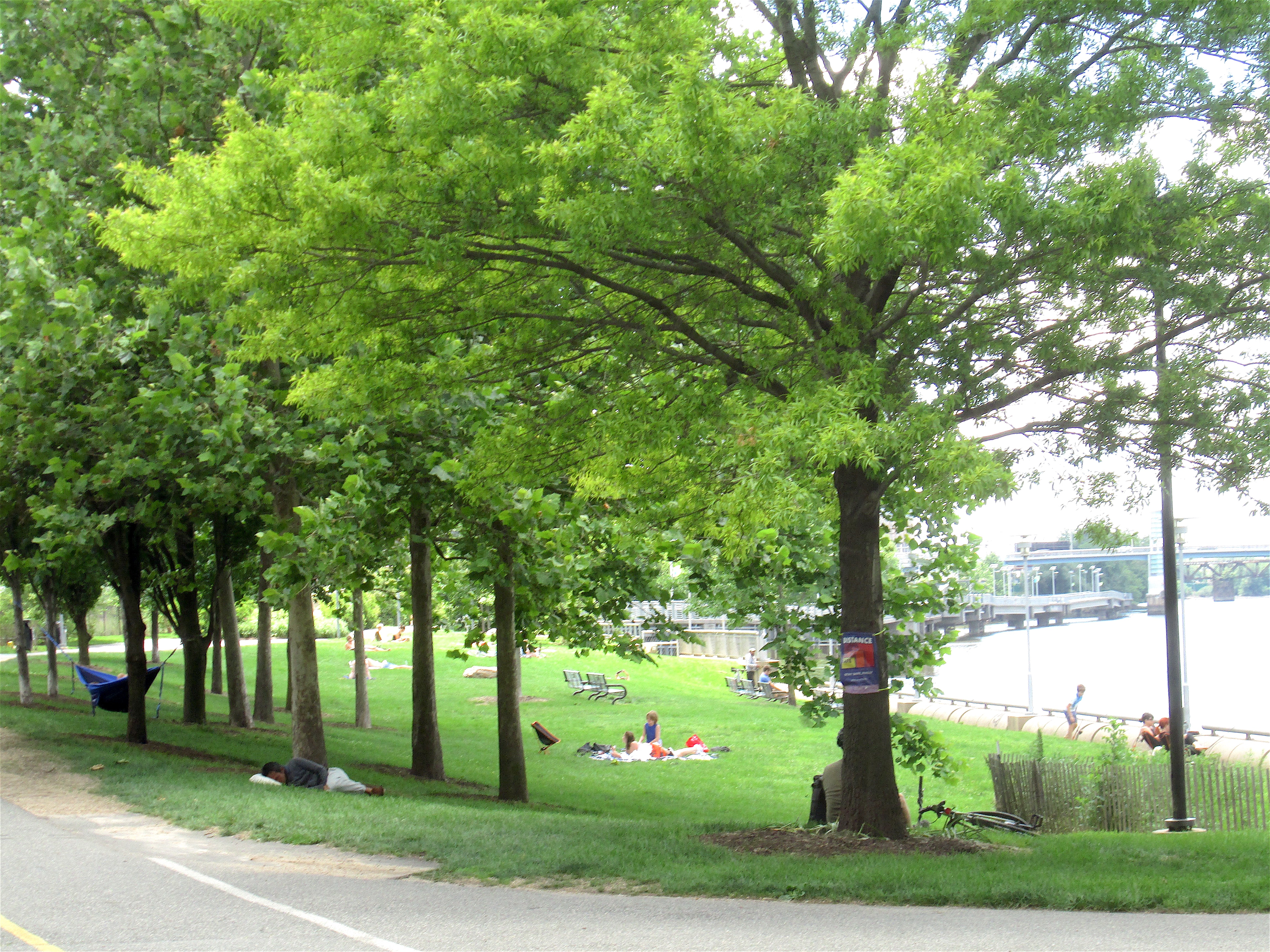
Streets like Elfreth's Alley have the potential to be outdoor rooms. Here's a picture of Smedley street running north from Pine to Spruce. Smedley lies between 16th and 17th.


Not every little residential street looks like this, of course. But some do, and more could.

Most of these streets are lined with small dwellings that are two or three stories tall, and I think the low height of the buildings contributes mightily to the feeling of an outdoor room.

Urbanist Jan Gehl, in his Cities for People (2010), has interesting things to say about how people on a street relate to the buildings that line the street. He notes that humans are designed to look primarily horizontally, and down. Looking up is not so easy for us. We can readily take in the first two or three stories of a building; and we can with more difficulty relate effectively up to about five floors. (See, in particular, pages 39-42, 84.) 

Imagine you're trying to talk to someone leaning out a window. Fairly easy if the person is on the second or third floor; up to five stories you can probably still connect. Higher floors are essentially disconnected from the ground, or, as Gehl puts it on page 42, "Above the fifth floor, offices and housing should logically be the province of the air-traffic control authorities." 

With a three-story building the cornice at the top can signal the ceiling, which of course isn't there. Instead we have a room where the sky stands in for the ceiling.

Narrow Streets, High Walls

Higher walls create something different. I've been calling these narrow streets with high walls concrete canyons (to borrow a term from Manhattan). There are two basic things going on here: First, compression at the street level and, second, an invitation to look up - straight up at a sliver of the sky.

There's an old Latin epigram - per aspera ad astra. Here's a translation: Through difficulties we reach for the stars. 

So the compression on the ground reminds us of the limitations we face in our daily lives. And the sliver of the sky reminds us that we have higher aspirations.

Not a bad lesson for a street to teach. I suppose we could call such a street an open-air cathedral.

Medieval Gothic cathedrals, in particular, work this effect very well. For instance, the cathedral at Chartres in northern France has a nave that is 37 meters tall - about 120 feet. Not too shabby for a building built out of stone. And then there are the stained glass windows, particularly those high up, in the clerestory. 

I suspect that streets like 2300 Ludlow are probably cathedrals of commerce, and I don't expect them to match the effect of Chartres, but the compression at ground level and the invitation to crank our necks back and look straight up are the same.

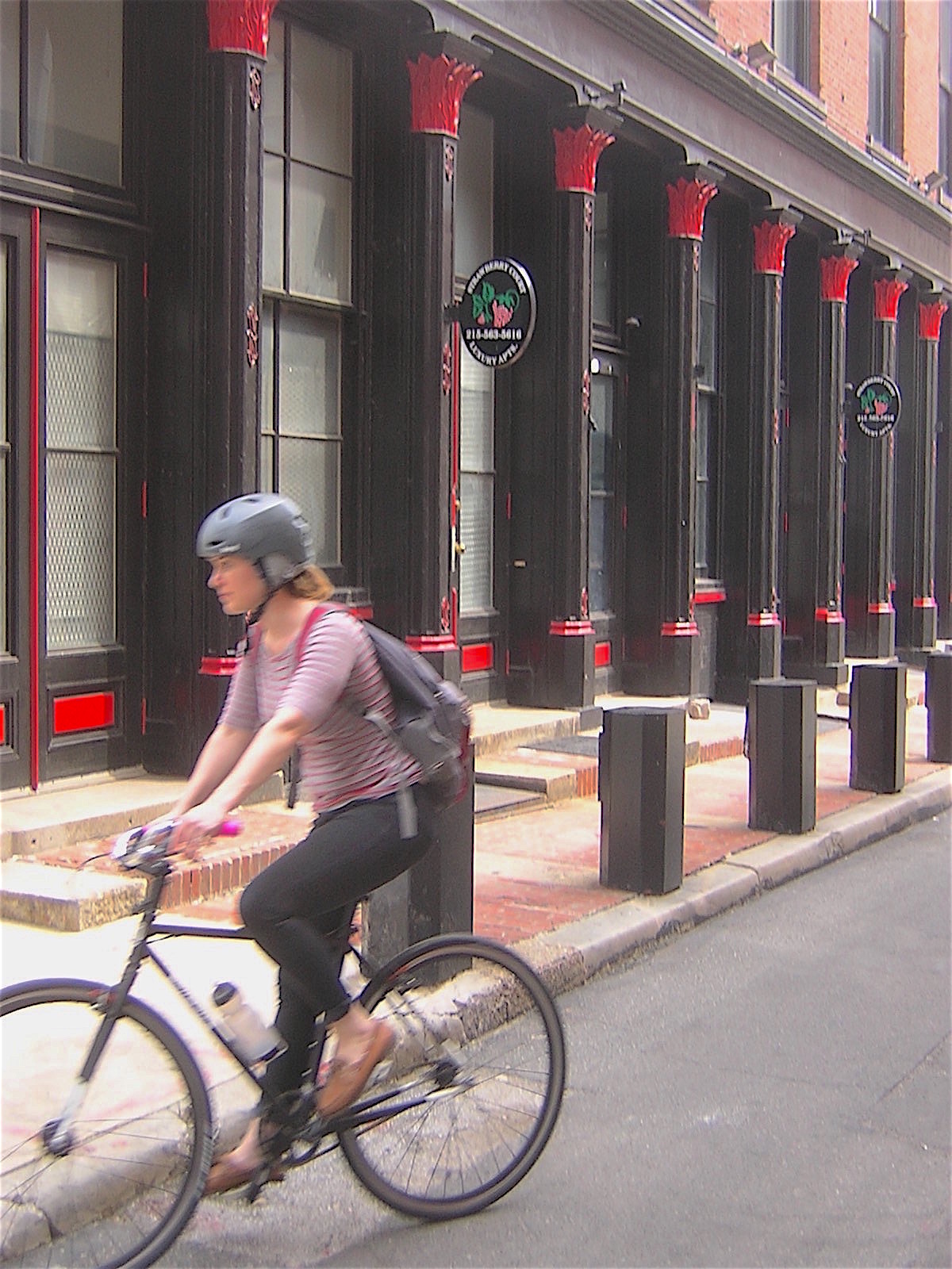
We have quite a few streets in Philly that pull this off with aplomb. A few years ago I found a happy hunting ground of sorts in Old City, north of Chestnut and west of Second. Here's a picture of Strawberry street, with the Custom House in the background. You will notice the truck, which gives you a good idea of the width of the street, and also the trash bins and a rather pensive man standing in the road. 


These are working streets, with delivery trucks bringing stuff in and trash trucks hauling stuff out. There's even the occasional car.

This block, as you can see, is blessed with quite a number of front facades. However, in many of these little streets, you are looking primarily at the back or the side of buildings. This is definitely true of 2300 Ludlow, but I have some good news. 

The new building going up in the 2300 block of Market will take up the whole block from 23rd to 24th, and extending to Ludlow. However, it will not be demolishing the large building at 23rd street, which has lovely facades on Market, 23rd and Ludlow. It will be incorporated into the new building. So the facades you see below, on 23rd and Ludlow, will remain, along with a similar facade on Market.


The Blank Wall Problem

I think our new open-air cathedral will have a very nice north wall. As for the south wall, I think it's time to say, with the astronauts of Apollo 13, "Houston, we have a problem." 

The building on the south side of the street is primarily a parking garage with some offices, none of which open onto Ludlow. What we have on Ludlow is a blank wall extending from the ground to the sky, punctuated by openings that allow the tailpipe emissions to dissipate.

We have a lot of these blank garage walls in Philadelphia, and they share one thing - they're very boring. There's basically nothing to look at.

It's possible to make them less boring. One option is throw a fabric screen over the whole thing. Then you can illustrate in any way you want. Here is a small-scale screen fronting a construction site on Sansom at 16th.


I'm more partial to paint on masonry, as in the picture below. This garage is at 12th and Walnut.


Not boring. Think of the people in the new building on the north side of Ludlow. The new building will have lots of windows looking out to the garage, and the people inside the building will be glancing out the window occasionally. We don't want them to be bored to death. Perhaps we could even amuse them.

At Ground Level

My main concern, however, is for the people walking by at ground level. What will this canyon feel like to someone on the street?

Remember that we humans spend most of our time looking horizontally, or a little bit down. The walls at the ground floor are therefore crucial to the pedestrian's experience. So how much variety in the ground-floor visual experience do we need?

Jan Gehl says that, on commercial streets, the ideal width for a storefront is around 19 feet. (Gehl visited Philadelphia in 2016 and walked Market Street from Old City to City Hall with Ashley Hahn of WHYY's PlanPhilly. For the resulting story, click here.)

It's easier to meet this goal on a commercial block that has a string of small shops. That's why the shopping areas on Walnut and Chestnut are more successful than the commercial frontages on Market and JFK.  

Not every street is going to be lined by shops, or interesting residential facades, but the pedestrian's need to be amused is a constant, and walkers will tend to walk where they know they will find interesting things to look at. How do we keep people interested when they're walking down a block like 2300 Ludlow?

I don't foresee anyone opening a trendy boutique here. I expect that this will always be mainly a space that people pass through, rather than a place where people linger. But still I think it should be a space that people enjoy passing through, and possibly even remember fondly.

One thing not to do is put up a blank wall. Unfortunately, this seems to be an acceptable solution for at least some architects and developers in Philadelphia today. Here's a nearby wall on a relatively new building that's even blanker than the parking garage. This one is in the 2200 block of Ranstead, barely a stone's throw from 2300 Ludlow. 


Even the decrepit north side of Ludlow is doing better than this. Have a look below.


You may not like this assemblage very much, but I'm a pushover for ramshackle. 

Just as a reminder of the potential that these spaces have, here's a picture of a facade on Bank Street, in Old City.


This of course is an actual building facade, but architects have a whole footlocker full of ornaments that can dress up a blank wall. My favorite is the pilaster, which dates back to ancient Greece. Such ornaments have generally fallen out of favor.

As with the upper floors discussed above, my go-to solution for the Blank Wall Problem at street-level is a mural, which is also an ornament. However, in Philly at least, murals seem to have gained some acceptance, and they do save you from what may be the only alternate solution, which is to completely redesign whatever is behind the blank wall and add some windows and possibly a door or two - in other words, to create an actual facade.

I've given the matter some thought, and I think the dreadfully boring ground-level wall on the south side of 2300 Ludlow needs a mural. Not just any mural. As a street-level mural, it needs a lot of detail, and a lot of different things going on, and, I think, people.  For this particular site, I think the mural should be an imaginary streetscape from around 1900, complete with pushcart vendors and happy merchants standing in the doorways of their shops. Maybe a cat snoozing in a shop window. A few well-behaved dogs, children playing with hoops, perhaps a mother selecting apples from a pushcart while holding her baby in her arm (motherhood could be complicated even then).

A Room with a Floor

Why all this nostalgia? Let's have a look at the third piece of our cathedral - the floor.

On one of my early visits to this block, I noticed that the asphalt pavement was badly deteriorated, and then I noticed, peeking out of the holes in the blacktop, something remarkable: bluestone pavers.


Under the tarmac, it turned out, was a whole city block of old bluestone pavement, suitably mangled by the ravages of time. And I thought to myself: "What a fabulous gimmick!" A bluestone street. I know of only one intact bluestone street in the larger Rittenhouse area. It's in the 1400 block of Waverly, behind Peirce College. Perhaps we could daylight the bluestone in 2300 Ludlow and restore the inevitable defects. Then the area would have two bluestone streets.

Here's a shot of 1400 Waverly.


And here's a close-up of some of the bluestone. You'll note there are a few red bricks, presumably filling in for damaged bluestone.


I think bluestone is gorgeous, providing an attractive and unusual backdrop for the surrounding red walls, and also giving us a little history lesson: Years ago, our city looked very different, often in ways that are now hard to imagine.

If it's not possible to restore the bluestone pavement on 2300 Ludlow, perhaps it would be possible to salvage the viable bluestone at that location and use it to replace some of the red bricks currently being used in the 1400 block of Waverly. I actually like the red bricks, but I would love to see a bluestone street in close to its original state.

________

ALAS, my bluestone proposals have been overtaken by events. This block of Ludlow was recently repaved with asphalt, and the bluestone pavers will sleep again under the asphalt, for a few more years.

See also Second and Chestnut, This Isn't Just Any Alley, Gordon Cullen and the Outdoor Floor, Small Streets Are Like DiamondsA Few Deft Touches for Back Streets, Buried Under the Tarmac.

Monday, November 7, 2022

Art Meets Sewage

An Odd Couple Just Turned a Parking Lot into a Destination


The end of summer strikes me as a happy time in Asbury Park. There are the events we look forward to, such as PorchFest and SeaHearNow. And then there is the occasional surprise, like the sprouting of a new wall of murals on the south side of the city's sewage treatment plant, just a few steps from the boardwalk.

On my walks, I enjoyed watching the artists at work, and it struck me that they were happy as well. And the results are impressive. 

This one is my favorites. You can't see them here, but she's wearing inline skates.


The title on this one is The Wizard, but I think he's actually the very latest take on Tillie.


Flower for Ukraine. I always find myself lingering in front of this one,


Here's a large horizontal piece. Nice variation from the verticals and squares


And here is a wide shot over the grassy berm that largely obscures the parking lot from the street, showing how the murals work with the plant, the apartment tower and - of course - the sky.


See also City of Lights.

Thursday, October 6, 2022

The Uncertain Eighties

Asbury Park Without a Rudder

That building in the distance is now the Asbury Hotel. 1984. 

What's a beach town to do? After World War II, America built a new world based on suburbs, interstate highways, and jet airplanes. A town built in the railroad age faced the problem of irrelevance. A number of its competitive advantages, including proximity to New York City and Philadelphia, now looked like liabilities. 

Think about that: All of a sudden, proximity became a liability.

With the advent of jet travel, people who wanted to go to the beach for a week could now go to Florida, or the Caribbean. Or the south of France, if they had the money. 

All those options, and there was Asbury Park - nearby, familiar, comfortable, but perhaps lacking in the romance associated with fast cars, faster airplanes, and more exotic destinations.

The town was predicated on hotels. The day trippers might still come, but the loss of hotel business was a terrible blow to the business plan the city had been following since 1871.

And there didn't seem to be anything to replace it. 

With the loss of hotel jobs, the people who had worked in the hotels - many of them black - faced an economic crisis that affected them individually and also the city as a whole. 

At the same time, the growth was in the suburbs, and it was massive. The city risked becoming a place left behind, occupied by people left behind. And many of those people were black. 

While court decisions and new laws were suggesting that segregation might become a thing of the past, the development of suburbs and interstate highways indicated that our built environment was moving in the opposite direction.

Walter Greason, in his Suburban Erasure: How the Suburbs Ended the Civil Rights Movement in New Jersey (2013), provides a vivid description of how suburbanization cemented a modern form of segregation in Monmouth County. 

In the 1960s, economic and racial issues, and the Vietnam War with its voracious appetite for young, male draftees, combined to produce a series of riots in America's cities. Asbury Park's turn came in 1970; it has often been portrayed as a unique event that came out of nowhere and ruined the town overnight. Actually, the riot was more a symptom than a cause.  

And the national trend toward poor black cities surrounded by prosperous white suburbs continued.


1978.

Asbury Park did not collapse immediately after the civil unrest. Instead, changes that had been going on at least since World War II continued. It was a long, bumpy road downhill.

The decline and fall persisted through the seventies. I started coming to Asbury Park in the late seventies. I'd married a Jersey girl whose parents lived outside Asbury Park, and we could combine family visits with time at the beach.

I had worked for the New York City Planning Commission during the fiscal crisis of the mid-seventies, and I got fired twice (the second time stuck). So I don't think I was naive about the potential for a city, large or small, to collapse. In the late seventies, I thought Asbury Park had the potential to pull through. By the eighties, though, I found it hard to tell what was going to happen next. Which is why I call them the uncertain eighties. 

Around the middle of the decade, my wife's parents moved to Florida, and we no longer had much reason to go to Asbury Park. In time there were funerals, and then visits to cemeteries. On these occasions we would usually take the time to ride around town a bit. Things just kept getting ghostlier, but we were basically disconnected. One of my main motives for writing this story was to get a better sense of what happened to Asbury Park, and when.

The Tick-Tock

What follows is a timeline for Asbury Park as it declines, collapses, and rises like a Phoenix from the ashes.

1946: Desegregation comes to Asbury Park.  The following is from Joseph L. Bustard, "The New Jersey Story: The Development of Racially Integrated Public Schools," The Journal of Negro Education (Summer 1952), pp. 275-285. It is available on JSTOR if you have access.

"[I]n the City of Asbury Park, the Board of Education, as the result of protests from Negro parents and not court action, decided that in September of 1946 a large elementary school which up to that time had been divided completely in half with two principals, two sets of teachers, and two sets of classes for different races, would be completely integrated the following term. This was done and the Negro principal, again because of seniority, was placed in charge of the building with an integrated faculty. Here an honest report cannot overlook the fact that when the school opened in September a number of pupils were withdrawn and sent to a nearby parochial school. It was unfortunate that at this time a drive was also on to get many of the so-called Italian-American parents in the neighborhood to use the parochial school. Therefore, it was impossible to determine to what extent integration was the cause of some of the withdrawals. It can be reported, however, that there were no unpleasant incidents either at the time or since."

Daniel Wolff, in his Fourth of July, Asbury Park (2005, 2022), notes this incident on pp. 92-93, quoting a black graduate of the school. In 1946, "They had 300 white folks," recalls the graduate, "and every one of them went over to Ocean Township." 

Ocean Township, 1979.


The school in question was the Bangs Avenue Elementary School, now known as the Barack Obama Elementary School. It is located near the western border of Asbury Park.

1946-1957: The Garden State Parkway is built.     

1954: The U.S. Supreme Court, in Brown v. Board of Education, says that segregated schools violate the Constitution. 

1958: The Boeing 707 jet airliner enters regular service

1960: Monmouth Mall opens in Eatontown, about six miles from Asbury Park. 

1964-1975: The Vietnam War causes immeasurable damage to the social fabric of the United States.

1965: Ocean Township High School opens, draining students and teachers from Asbury Park High. 

1966-1976: In their 2021 book, Gentrification Down the Shore, Molly Vollman Makris and Mary Gatta report on page 31 that "in Asbury Park, there were 10,000 hotel and motel rooms in 1966. By 1976, there were fewer than 1,500." 

1982.


July 4-11, 1970: "At the time of the riots, Springsteen was living in a surfboard factory out on the edge of town. When he heard about the riots, he climbed a nearby water tower. As Springsteen remembers it, he wasn't surprised that the West Side was burning; after all, this kind of thing had been happening all over the country. Not surprised, but stunned by the sheer magnitude of the event. From the top of the tower, looking out across Route 35 toward the ocean, Springsteen felt as if he were watching his whole city go up in flames." (Wolff, Fourth of July, Asbury Park, p. 115.)

1973-1983: In what we may call the Drinking Age Rollercoaster, in 1973 the state of New Jersey lowered the legal drinking age from 21 to 18. It then raised it to 19 in 1980, and back to 21 in 1983. These legal changes probably contributed to the popularity of The Circuit, a loop on Ocean and Kingsley, just inland from the beach, where young men and women cruised in their cars during the evening hours, ogling one another and perhaps introducing themselves. The people I ask about The Circuit generally smile at me and apparently have happy memories that they're not prepared to share. I think this evening paseo, as the Spanish might call it, probably made Asbury Park look healthier than it actually was during this decade. (For a little more on The Circuit, see Layers at the Beach Front.) 

Boardwalk, 1982.


1974: The Great Adventure theme park opens on 1,500 acres in Jackson, New Jersey. (See Judith A. Adams, The American Amusement Park Industry, 1991, pp. 120-121.) Asbury Park simply cannot play in this league, and shouldn't try. 

1977: The Steinbach department store chain opens a store in Seaview Square Mall, just west of Asbury Park. 

1979: Steinbach closes its downtown Asbury Park location, on Cookman Avenue. 

1980s: In a movement known as deinstitutionalization, New Jersey and other states moved large numbers of patients out of psychiatric hospitals and into the community, where promised support systems were severely underfunded.  In his Fourth of July, Asbury Park, Wolff reports that, at one point in the 1980s, "Asbury Park had seven hundred state-licensed beds for ex-patients and an uncounted number of unlicensed ones." (P. 132.) 

The deinstitutionalization movement began in 1955, when the introduction of Thorazine, the first effective antipsychotic drug, created the possibility of treating large numbers of patients in a community setting. The movement took off in the mid-sixties, when the creation of Medicare and Medicaid offered new sources of funding. (For a 2021 story in The Atlantic, click here. For a recent editorial in the New York Times, click here.) 

The patient population of Marlboro Psychiatric Hospital in Monmouth County peaked at more than 3,000 in 1955 and then declined steadily until the 1970s, when it leveled off below 1,000. The hospital closed in 1998. 

Boardwalk, 1984. 


1984-1995: According to the Concert Archives website, there were no concerts in Convention Hall between 1984 and 1995. In 1967, there were 17 concerts; in 1983 there were three concerts. 

1985: The Asbury Park Press moves its news and business departments to neighboring Neptune. The manufacturing facilities had preceded them, moving in 1980.

1988: "The state of New Jersey has fined Asbury Park more than $1 million for causing the ocean pollution that closed a popular stretch of Monmouth County beaches for 19 days this summer." - Jesus Rangel in the New York Times, October 16, 1988. To see the full story, click here

Businessman Henry Vaccaro has been publishing his reminiscences serially in the Coaster, and on June 9, 2022,  he recalled the 1988 problem with the sewer plant: "That was the ruination of the summer of 1988. It not only killed the beach revenue for the city but destroyed the hotel bookings that summer and the summers to come." 

Vaccaro also noted the damage to Convention Hall's business that year: "We then got a double whammy as the trade shows now started to leave Convention Hall which is directly on the ocean and across the street from the hotel. One by one 13 major shows cancelled and left the hall, starting with the Boat Show, the Hunting and Fishing Show, the RV and Camper show, the Home Remodeling show and the Physical Fitness show." 

1988: Palace Amusements, which had opened for business in 1888, closes

I think 1988 was the nadir, or low point, and I think the nineties were the worst decade.

1992: The Casino's carousel, located in the carousel house, moves to Myrtle Beach, South Carolina. 

2001: A minor-league baseball team called the BlueClaws arrives in Lakewood. I'd like to see Asbury Park get a minor-league baseball team, but I think the niche is taken. 

2002: "Three days after resigning as mayor of Ocean Township, Terrance D. Weldon pleaded guilty today in federal court to extorting nearly $70,000 in bribes from developers in exchange for successfully shepherding their projects through the approval process.

"Mr. Weldon, 53, a popular figure who had served as mayor or councilman since 1989, resigned his elected post as mayor on Monday. He also stepped down from his appointed position as city manager of the adjacent community of Asbury Park, where he had served as a firefighter for 26 years before retiring in 2000 as chief of the department.

"Residents were surprised by his decision to retire and shocked when he added that he was doing so because he had broken the law and would appear in federal court later in the week to answer for his 'reprehensible' conduct." - Ronald Smothers in the New York Times, October 11, 2002. To see the full story, click here

2003: "Local officials say redevelopment is really coming to Asbury Park this time, after a new City Council, elected in July 2001, appointed a new city manager, settled lawsuits with the bankrupt developer of the 11-story skeleton and approved a new redevelopment plan on June 25, 2003." - Jerry Cheslow in the New York Times, July 27, 2003. To see the full story, click here

Ocean Avenue, 1987.


Reconnecting

It was in the mid or late 2000s when my wife and I started to come to Asbury Park more regularly - still going to the cemeteries but also just day-tripping to the beach. One afternoon, on the way back home, we were driving up Cookman Avenue through the commercial district and noticed that there were no open parking spaces - not one. My wife said she wished her parents could come back for just one day to see that. 

I agreed. One thing led to another, and we wound up buying a small apartment not too far from the beach.

I love the idea that neither one of us can place the year we saw that wonderful parking congestion on Cookman Avenue. Real-world history has holes in it, and I like it that way.

1987. 


The Perils of Planning

As the Scottish poet Robert Burns noted, "The best laid schemes o' Mice an' Men gang aft agley." This is true when things go horribly wrong. It's also true when they go well. Asbury Park is on a roll right now, and I expect it to continue. But I would like to note that Asbury's redevelopment plans seem to have focused on building a densely populated residential community near the beach. I expect that this will come to pass. However, I think there are two important ways in which life has deviated from the plan. 

First, I think the backbone of Asbury's residential boom was actually further inland, and it was driven by incoming gays and creatives, along with some very happy realtors. Check the dates. In 2003 the Times is talking about individuals coming to town and finding gems at bargain prices. 

The big money came along later, and I for one am very happy to see it. But it didn't come until the pioneers had made the place attractive.

Second, the redevelopment plans seem to have missed the idea that Asbury is not viable if it doesn't attract visitors. With amusements. The carousels are gone, but I think we're going for several demographics here, and we should be looking at what specifically attracts them. So there's the beach, and we seem to be doing very well with the day-trippers. And there's the music. Again, we seem to be doing well here. And then there's food and drink, and we seem to be doing well with both.

There are of course the young hammerheads who come to Asbury to consume mass quantities of beer, and then pour themselves onto a train and possibly even sober up before they get to the station where they left their car. Others presumably get home by Uber or a designated driver. At least, I hope that's what happens.

There's another demographic that I think people may be missing. It is the massive number of people who are now living in the interior of Monmouth County. They're not necessarily young, and they live in subdivisions populated by prosperous citizens. And, in my opinion, they're often bored of an evening. And they are willing to come to Asbury for a nice meal that doesn't feel mass produced, and then maybe go for a walk on the boardwalk. 

The big money seems to be interested in attracting wealthy film stars from Manhattan and getting them to buy a million-dollar pied a terre at the beach.

I think that's nice, but I'm more interested in getting repeat business from folks in Monmouth County, who have a very short drive to get to the beach. And other parts of the suburban state of New Jersey, where people have money and are bored in the evening, and can get to Asbury without a very long drive.

And I think you could get that demographic to come twelve months a year - and not just for dinner but also for brunch and lunch on the weekends. Having stable year-round employment at restaurants and a few hotels and possibly some other attractions would, in my opinion, be an unalloyed positive.

Sunset Avenue, 1982.


See also Layers at the Beach Front, The Wreck of the New Era, City of Lights.

Wednesday, September 21, 2022

Coney Island 2022

The Phoenix Arises from the Ashes 

Luna Park, Coney Island. Est. 2010.

I've spent a good bit of time learning about Coney Island during its formative period, which was before World War I. Somewhere along the line it occurred to me that I had only the haziest idea of what Coney Island looks like today.

My daughter, who lives in Brooklyn, decided this was a gap that needed to be filled, and so she organized a family expedition to Coney Island.

B&B Carousell.


Saturday, May 21, a beautiful late spring day. We rode the Q train out to the Stillwell Avenue stop, which is about two blocks from the Atlantic Ocean, and as we were leaving the station we noticed large numbers of unusually dressed people coming into the station. It turned out that they were runners who had just completed the Brooklyn Half-Marathon and were now heading home by subway. 

Coney Island beach from the Steeplechase Pier.


The last time I had visited Coney Island I was also running the Brooklyn Half. May 30, 2009. We started in Prospect Park and then ran basically down Ocean Parkway to Coney Island. When I finished I found my family and we walked onto the beach. I took my running shoes off, tied them together, slung them over my shoulder, and walked into the water up to my waist. A good ice bath for the legs and hips.

A man asked me why I had carried my shoes into the water. I responded that I was sure I would need them when I reached the other side of the ocean. 

When my legs were properly chilled, I left the water, and the whole family went to Nathan's on the boardwalk for a hot dog.

Wonder Wheel (1920).


It was crowded at Nathan's on the boardwalk in 2009, but I was unprepared for the crowding at Nathan's in 2022. We scouted around and found Paul's Daughter. Not far away. I enjoyed my hot dog.


At this point we were actually near the end of our visit. We had already walked out onto the Pat Auletta Steeplechase Pier, which was much less crowded than the Riegelmann Boardwalk, and gone for a ride on the famous B&B Carousell

We also found a bunch of more modern rides aimed more or less directly at my five-year-old grandson. He and his father even rode a mini roller coaster, which had just the right thrill level.


The rebuilding of the Coney Island amusement zone is a success story. Its historical antecedent, developed largely before World War I, is still present in diminished form. 

For years, the New York City government had seemed intent on erasing the Coney Island amusement zone from the face of the earth. But at some point after Fred Trump, Donald's father, demolished the Steeplechase Park pavilion and destroyed its famous image of Funny Face, there was a change of heart, or at least strategy, and the City started investing in an amusement area that had, to its credit, refused to die.


And so we now have an updated amusement area, bookended on the west with a stadium for the minor-league Brooklyn Cyclones (who arrived in 2001), and on the east side by the New York Aquarium, a refugee from Lower Manhattan and the Bronx Zoo that arrived in 1957. In between the new, there are many pieces of the old. The 1923 Child's Restaurant, for instance, has received landmark status and now continues its journey through history as a live entertainment venue. 

And the City has also put a lot into infrastructure. The 1923 Riegelmann Boardwalk has been extensively renewed and revised in recent years, and the City designated it a scenic landmark in 2018. The Pat Auletta Steeplechase Pier dates from 1907. It collapsed in 1992 and was rebuilt and enhanced. It was damaged by Hurricane Sandy in 2012 and was rebuilt and enhanced again.

Other infrastructure work has included the extensive reworking of Coney Island's two main subway stations: Stillwell Avenue and West 8th Street. The latter serves the New York Aquarium and is noted for Vito Acconci's fluid Wavewall of 2005, a nod to the Atlantic Ocean's waves that are just the other side of the Aquarium. 

So what can Asbury Park learn from the new Coney Island? I think this: People still like amusement parks. The Disney parks, and others, have accustomed people to something very different from the old parks. The new model is clean, sanitized, scrubbed of any hint of sexual release. 

Sex had been an element of American amusement parks from the beginning, when Little Egypt (and others) appeared on the Midway of the World's Columbian Exposition of 1893 in Chicago, and introduced America to belly dancing. (See John F. Kasson, Amusing the Million: Coney Island at the Turn of the Century, 1978, pp. 23-26.) 

Parachute Jump (arrived 1941). 


But today's amusement parks have found that they can leave titillation to the Internet. People are still looking for the amusement park's basic offering - a slightly different world, something that takes them out of their daily lives and allows them to dream of a different life.

I'm particularly concerned with the young people. Maybe I'm just a nostalgic grandparent, and it's true I become a child again when I get on a carousel. But I think Asbury Park could do more for children. And I think children who are jaded by their parents' iPads would respond to experiences that are non-virtual - tactile, visceral, fanciful, and even perhaps liberating.


See also Night Lights at Coney Island, Layers at the Beach FrontJim Crow Was a Failed State.

Tuesday, September 6, 2022

By the Market Street Bridge

Can Things Be Looking Up?

Coming off the ramp from the Schuylkill Banks.


In my kinder and gentler moments, I have been known to refer to the 2300 block of Market Street as a godforsaken hellscape overrun by rampaging cars. But I think I may be about to change my mind. Things may actually be getting better here. 

For starters, there's a new addition coming to the block, on the south side of the street, across from the black Peco tower on the north side. The current plan is to redevelop this space as a biotech center, preserving several of the existing facades. The larger new structure will provide a nice frame for the old facades while also making a modern statement of its own. All in all, I'm quite pleased with the evolution of planning for this area, and I'm thrilled that these dead buildings will be incorporated, at least in part, in a new life that will make this block much better. At least that's the plan. (For an article in Philadelphia YIMBY, click here.) 

Dining al Fresco on 24th Street

Let's take a walk westward on the south side of Market, starting at 23rd street, where the new development is planned. You may notice, as you walk west from 23rd Street toward the Market Street bridge, that you are walking up a hill. The hill is actually the ramp up to the bridge. As you get to what would  be 24th Street, there is a gap in the building facades, and you can look down to the real 24th Street. I did a little walking, and actually got a shot of this space looking north, back towards Market and the Peco building.

Sunday lunch on 24th Street.

Talk about an adaptive reuse of a dead-end street. Talk about embracing our industrial past.

And talk about designing in three dimensions, and erasing the hard line between indoors and outdoors.

24th Street here is about two stories down from the surface of Market Street. The building on the west side of 24th - 2400 Market, better known as the Aramark building - has a north-south walkway that looks down onto 24th Street and runs all the way from Market to Chestnut. There is a little branch of this walkway that goes to a parking garage on the east side of 24th. I took the picture above while standing on that little branch (or bridge, if you want to be fussy). 

Coming up with this stuff requires imagination.

Further west, the Aramark building has another, very nice, walkway that overlooks the river and also lets you promenade between Market and Chestnut. There are benches, and it's quite pleasant. 

The view to the west may not enthrall everybody, but I find it interesting. You're basically looking at the guts of the city's transportation system as it has evolved over the centuries. The river, the railroad, the expressway. I like to call it Schuylkill, Schuylkill, and Banks. Has a nice ring to it.

Here's a picture of the railroad from the Market Street bridge, showing the Aramark building and its promenade on the left and the Schuylkill Banks on the right, with the ramp system that connects the bridges on Market and Chestnut with the Banks at ground level.


Learning from the Schuylkill Banks

I'm going to leave Market Street for a bit, and look more closely at the Schuylkill Banks in this area. I think there are some lessons here that could be applied on Market Street, and, frankly, in a lot of other places. 

First, some history. In the days before railroads, the Schuylkill River was a very busy place. Now it is mainly empty, with a few pleasure boats, and the boat below, which is picking up trash. It's possible that, as it has grown less active, the river has grown more picturesque.


As we go further south on the Banks, we come to yet another bridge - this one is a bridge that picks up pedestrians and bicyclists and hoists them across the railroad tracks, around Spruce Street.


The picture above came from this bridge. I think many people find long lines of railroad cars - boxcars, flatcars, oil tankers - tedious. I don't, but I do understand the urge to decorate. 

A few feet away, this is what the Schuylkill Banks looks like.


And if you go a block inland, you have scenes like this one on Panama Street.


Lessons to Learn

So why have I brought us all the way down from Market Street to Panama? Basically to show you how very different uses of space can be braided together and allow each use to do its job while allowing the other uses to do their jobs. This idea, weaving theoretically incompatible uses together, actually works on the Schuylkill Banks. The Markward Playground has a lovely area for small children that is located right next to the train tracks. The trains and the kids get along just fine. There is a fence. 

The uses don't ignore one another. I would argue that they gain by having somewhat incongruous neighbors. One of the reasons why people come to cities is to rub shoulders with people who are different. Why should pieces of ground not do the same?

If the Schuylkill Banks can live with the train tracks, then Market Street can live with a bicyclist and her child mounted behind her. The question is how. And I think that the success of the Schuylkill Banks can suggest some answers. First, separate the different types of traffic and activities; second, weave them together so that everybody can get where they need to go. 

On the Banks, of course, some people just lie quietly on the grass or in a hammock and don't do anything or go anywhere. 

I'm not expecting a lot of napping on hammocks on the Market Street bridge, but I do think the idea of separating different kinds of traffic and then braiding them together intelligently wherever necessary - at intersections, for instance - would be remarkably helpful.

This would not solve all the problems on the 2300 block of Market, but I think it would help a lot.

I need to hammer home a point: Each of the zones we're talking about needs to find its own path to civilization. They should not all look alike. They have different tasks and should be designed to perform those tasks. But all of them can be civilized, and if they are, they will fit together to make a coherent and very pleasant slice of the city. 

Back to Market

Let's go back to Market Street. Remember the photo at the top of this story - the bicyclist and her child. In the background you may notice a sliver of the Peco building. This building is large and black and very much of its time - 1970, to be exact. Most people driving by in a car probably only notice the tall black hexahedron. There are actually a number of other, smaller hexahedrons flanking the base of the tower. These smaller black boxes join together behind the tower and form a continuous facade along John F. Kennedy Boulevard. This facade on JFK has no entrances and no signage, with the exception of a few small notices that trespassers are unwelcome. 

Let's go back to the Market Street frontage. On each side of the main entrance there is a plaza with a nice collection of trees. The street slopes here - remember you're on a bridge ramp - but the Peco building rests serenely on a horizontal plane, and so the eastern plaza is reached by steps up, and the western plaza is reached by steps down. The main entrance and the sidewalk are actually at the same level.  

On the eastern plaza - the one with the steps up - there is a special entrance for Peco customers seeking solutions to problems. Here's a picture.


I have a problem with this entrance. In what way is it welcoming? How does it seek to create a feeling inside me that the people on the other side of the door will be nice to me, and perhaps even help me?

To me, at least, this entrance is cold and intimidating. 

I don't really believe that Darth Vader lives in the Peco building. I do think it's a black hole in space that drains energy from the whole block. 

It would be nice if a restaurant opened on the ground floor, with seating on the west plaza looking out to 30th Street Station and the old Post Office building. I do not think this will ever happen.


The Peco Parking Lot

On the other hand, I do think there are some significant, and possibly feasible, improvement opportunities on the block directly to the east of the Peco building, where Peco has a simply enormous employee parking lot.


(This picture is from the height of the pandemic. The statement that the lot is full is obviously false, but I learned in my corporate career that such statements should not be seen as false, but rather as "aspirational.")

This lot does not conform to Philadelphia's current design standards for parking lots. It doesn't have to. It was in existence when the new standards came in, and under the law it is grandfathered. So, no wrought-iron fences, no trees, no plantings of any kind. Essentially a visual disaster.

If it wanted to, Peco could comply voluntarily with the current design requirements for parking lots.

It could also put greenery at the curb, on Market, 23rd, and 22nd. I understand the conditions underground might not allow for tree pits in some places, but then there are planters.

Taming the Cars

That brings us to the street itself, a large and largely shapeless place where cars, buses, and trucks move quickly and maneuver abruptly in vast numbers. During the reconstruction of the Chestnut Street bridge, there was a protected bike lane on the south side of Market Street, from Schuylkill Avenue to 23rd. This has now gone away.

Meanwhile, the City has been working on putting a two-lane cycle track on Market, between 20th and 23rd. The necessary legislation has been passed, and construction is expected to start sometime this year. (For a brief description of this project, click here.)

West of 23rd Street, Penndot is getting ready to renovate the Market Street bridge. I long ago gave up trying to predict what Penndot may or may not do, but I'm hearing good things. A decent set of bike lanes here, or a two-way cycle track, could provide relatively clear sailing across the bridge and also connect to the ramp from the Schuylkill Banks. West of the river, Market is not a great place for bikes, but there are decent bike lanes on Walnut and Chestnut that extend well into West Philly. The recently revised Chestnut Street bike lane is, frankly, a gem.

What Does It All Mean?

Years ago, when I was commuting by train to New York, the Schuylkill Banks did not exist. I would leave 30th Street Station in the evening and sometimes I would walk toward home across the Market Street bridge. The bridge was a bit scary, because of the traffic; and then the stretch of Market east of the bridge always reminded me of Dante's line: Abandon all hope, ye who enter here. The Richard Basciano sex-industry empire dominated the area, especially when the few office towers emptied out at the end of the day, and the sidewalks were left pretty much empty. The Peco parking lot did not look out of place back then. All in all, not a great gateway to Philadelphia.

Everything that's now going on along this stretch of Market, from 20th Street to the bridge, suggests to me that we are about to fulfill a piece of Ed Bacon's vision of Market Street as Philadelphia's main axis, which he saw extending all the way to the city's western border. (See Edmund N. Bacon, Design of Cities, 1976, pp. 298-306.)

The emerging high-rise corridor along here is supported by abundant public transportation. There are quibbles and imperfections, of course. For historical reasons, the subway here, the Market-Frankford Line, does not stop between 30th and 15th Streets. (For more on this, click here.) But there are trolleys and buses. Five trolley lines run under Market between 30th Street Station and City Hall at 15th Street, stopping at 19th and 22nd. Seven bus routes have stops near the intersection of Market and 23rd. 

I think things are genuinely getting better in this space, and not just for real estate developers. The area may soon be much more walkable. The sidewalks may have more foot traffic. Crossing the street may no longer feel life-threatening. 

We may be in the process of making this stretch of Market Street safer, more useful, and more pleasant for all users. Will it be perfect? Certainly not. But I think we're about to take a big step forward in civilizing this street.


On its better days, the sign above says Walk Bike On Ramp. It's located at the top of the ramp that connects the Market Street bridge with the Schuylkill Banks. I think the decorations are a good reminder that users may disagree with the designers on how to use a particular piece of the built environment. Changing the design of the built structure is generally a more successful strategy than plastering the structure with signs. And this big ramp has been physically modified to prevent some of the most dangerous behavior. 

In general, the designers of the Schuylkill Banks have been good at these modifications. There is, for instance, another ramp nearby, a gentle one at ground level, right next to the river near the Chestnut Street bridge. It used to have a series of almost invisible steps. Unwary bicyclists found themselves going airborne with some frequency, and not always landing well. The steps went away. 

See also Putting Some Park into Old Parking Lots, Do We Secretly Want Ugly Cities and Dangerous Streets?

Wednesday, August 31, 2022

Asymmetrical Warfare

Never Give Your Enemy the Battle He Wants

Funeral for a Ukrainian soldier, early days.


I've been thinking about the American Revolution recently, and how the English soldiers - and particularly their officers - were incensed that the Americans would not fight like proper soldiers, lined up in a field or pasture, facing an opposing line from the other side, firing off a volley or two of musket fire, and then charging with fixed bayonets. Instead, the Americans hid behind trees and stone walls, and sniped at the English as they marched in a column down a charming New England dirt road in the equally charming New England countryside. And then melted away. 

Pretty much what the locals did to the Americans in the Vietnam war. 

Welcome to asymmetrical warfare. Here's a simple rule - never give your enemy the battle he wants. 

I think this is what is happening in Ukraine right now, and I think the media, as well as the Russians, simply don't understand what is going on, or how the dynamic of this war is going to play out. 

Because I think they're making the famous mistake of expecting to fight the last war - or maybe the last war they won. 

Everyone seems to be waiting for Kursk, the mammoth battle in 1943 that took place between the Russians and the Germans, killed simply fabulous numbers of soldiers - mostly Russian, but also great gobs of Germans - and essentially broke the Germans, who never recovered the initiative. It was the largest tank battle in history, and it took place near the Russian city of Kursk, which is not terribly far from the Ukrainian city of Kharkiv. 

Kursk is not going to happen in Ukraine. What will happen? I don't know. But I have some ideas.

The Russians want to replicate Kursk, fighting mainly with tanks and cannon. Their infantry sucks. Look for the Ukrainians to fight with infantry, probably at night, and probably in small groups. 

A lot of people, including me, were wondering why the Ukrainians held on so long in Severdonetsk. But, at the very least, they spent their time learning how to fight the Russians at night. Apparently the Ukrainians had night-vision goggles, and the Russians did not. But knowing your advantage in the abstract, and knowing how to use it, when lives are at stake, are two different things. 

The value of a tank on the battlefield has declined dramatically with the development of shoulder-fired antitank missiles, such as the Javelin, which proved very effective against the Russian columns advancing on Kyiv early in the war.

And then there are the drones, often bought at craft stores and MacGyvered to carry explosives over enemy lines and release them at opportune times.

And of course there are the missiles from the United States, which allow the Ukrainians to attack Russian supply depots and headquarters far behind the front lines. And also things like bridges.

Ukraine appears to have launched a major counteroffensive around Kherson. People still seem to be looking for battalions of tanks charging across fields of sunflowers.

I think the real action will not be on the "front line." I think forces will move forward to occupy "front line" positions that the Russians are no longer capable of defending, or have perhaps abandoned, because of activity in their rear that deprives them of food, fuel, ammunition, reinforcements, and contact with their headquarters.

The real infantry fighting, I think, will take place well behind Russian lines, attacking supply depots, military airfields, military headquarters, and choke points on supply lines. These would be bridges.  

I think the Russians have made a major mistake by putting gobs of troops into the Kherson area, on the wrong side of a river where the bridges are being pummeled by the Ukrainians. If those troops get cut off - and it seems like we're pretty close to that - you can look for long columns of Russian prisoners marching out to prisoner of war camps further inside Ukraine, where they will sit out the war. And possibly count themselves lucky to be out of a war where their commanders are such blithering idiots.

See also A Lesson From the Berlin Wall.